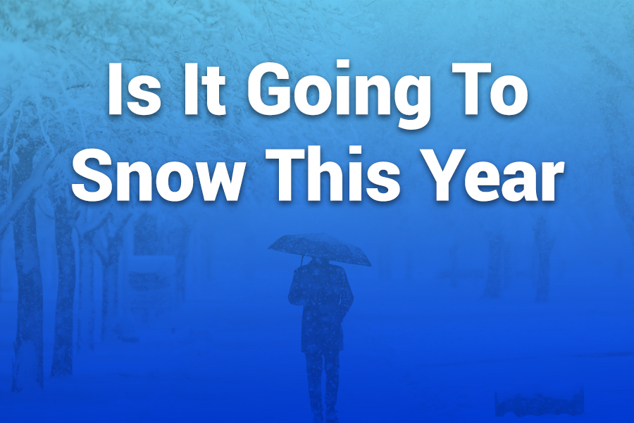
The short answer: yes, many parts of the United States should see a real winter with genuine snow chances. Signals line up for a colder, snowier pattern in northern-tier regions, with mixed but still notable opportunities elsewhere.
Long-range guidance points to a weak La Niña, early-season cold snaps, and storm tracks favoring the Northwest, Northern Rockies, Upper Midwest, Great Lakes, and sections of the Northeast. Southern areas trend warmer and drier overall, but quick Arctic bursts can still flip rain to snow for short windows. In this article, you’ll learn the big drivers, regional expectations, likely timing, city snapshots, and how to use forecasts to plan smarter.
What “this year” means for your winter
We’re talking about the 2025–2026 cold season. In practical terms, most places that get snow in a typical year should see it again. The atmosphere looks primed to deliver a “real winter feel” north of roughly the I-70 corridor, with better-than-last-year odds of plowable events in several major metros.
Early December and early February stand out as prime windows for the first and second big waves, with additional opportunities sprinkled in between. If you live along the northern tier, treat this season like a classic winter: cold shots, clipper systems, lake-effect bursts, and at least a few headline storms.
The big drivers behind this season’s snow
Weak La Niña tips the scales. The Pacific looks set to lean La Niña by the heart of winter. A weak La Niña often nudges the jet stream toward a colder, stormier setup for the Pacific Northwest, Northern Rockies, and into the Upper Midwest and Great Lakes. That same pattern can leave parts of the southern U.S. warmer and drier on average, but it doesn’t cancel out brief cold blasts.
Polar Vortex wobble potential. Early signs suggest the stratospheric Polar Vortex could run weaker or less stable at times. When that happens, cold air can spill south in pulses. Those pulses create short, sharp windows where rain changes to snow far south of the usual snow belts, even if the seasonal average stays near or a bit above normal in the southern states.
Early snowpack in the high latitudes. Rapid early-season snow growth across Siberia and Canada can help lock in cold air masses. That reservoir of cold often supports frequent clippers and lake-effect events across the northern U.S., especially when the storm track lines up with fresh Arctic highs.
The North Pacific “warm pool.” A warm blob of water in the North Pacific can load storms with moisture while also shuffling the jet stream. That combination sometimes pushes heavier precipitation into the Northwest and northern Intermountain West. It can also raise snow levels during mild spells, then drop them quickly when colder air arrives. Result: big gradient storms where elevation and timing decide whether you shovel slush or blower powder.
Timing: when snow is most likely
Early December: A strong opening act looks plausible. Expect the first meaningful widespread cold shots, fresh lake-effect bursts, and one or two broader storm systems that test road crews from the Northern Plains to New England. If you’re in the Mid-Atlantic or Ohio Valley, this period can deliver your first measurable snowfall if the right southern stream energy hooks into colder air.
Around early February: The pattern favors another winter “bookend.” This window often coincides with a reloaded cold supply, better snow ratios, and mature storm tracks. Great Lakes lake-effect bands intensify when the air aloft stays frigid, and Nor’easter threats tend to peak when moisture-rich lows meet entrenched cold along the East Coast interior.
Between those bookends: January rarely goes quiet from border to border. Expect clippers to pepper the northern tier with light-to-moderate snows and occasional larger systems to carve from the Rockies into the Central or Eastern U.S. Warm breaks still pop up, especially in the South, but fresh cold shots return on the heels of each frontal passage.
Regional outlook at a glance
Pacific Northwest: You should gear up for a healthy storm parade. Coastal lowlands see cold rain with occasional mixed or wet-snow episodes, but interior valleys and the Cascades score frequent snow. Ski areas benefit from repeated refresh cycles, though brief warm pushes can bump snow levels before the next cold shot drops them again.
Northern Rockies and Northern Intermountain West: Regular snows look likely, with cold snaps supporting good powder quality. Idaho, western Montana, and Wyoming stand to bank steady accumulations. When the jet undercuts cold air, widespread region-wide events set up, and mountain passes require chains.
Central and Southern Rockies: A north–south split makes sense. Northern Colorado and Utah do well when Pacific energy meets colder air. Southern Colorado and northern New Mexico ride a more variable pattern; your best storms arrive when a Four Corners low taps Gulf moisture into subfreezing surface temps.
Upper Midwest and Great Lakes: This is classic snow country this season. Look for repeated clipper snows and multiple lake-effect outbreaks, especially downwind of Lakes Superior, Michigan, and Erie. When synoptic storms sweep through, you can stack up quick, plowable totals—then reinforce the snowpack with backside lake-effect.
Midwest and Ohio Valley: You get a step up from last year. Cold shots pay more frequent visits, and a few synoptic systems track along the favored corridor from the Central Plains into the Ohio Valley. If you sit along the I-70 to I-80 band, watch for gradients: 50 or 100 miles north or south can mean the difference between rain, slop, or a tidy 6 inches.
Northeast and New England: Expect a stormier feel than last year. Interior New York and northern New England have better odds for above-normal snow, while the I-95 corridor battles marginal temperatures at times. The key will be timing: if cold air arrives 12–24 hours earlier, a rain event turns into a snow-to-mix special. Nor’easters remain on the table, especially late January into February.
Mid-Atlantic: Washington, Baltimore, and Philadelphia sit on the rain–snow knife edge many times a winter. You’ll see more legit shots this season, but you need the cold in place. When a coastal low tracks just offshore with antecedent cold, a 4–8 inch event comes together fast. If cold lags, it’s rain or slush with backside flakes.
Southern Plains and the South: Seasonal averages lean lower, but no one is immune. Fast-moving Arctic fronts can flip rain to wet snow or glaze roads with a narrow band of freezing rain. Treat any mid-winter cold wave seriously—power demand spikes, bridges ice first, and shallow cold can undercut milder air aloft to create surprise wintry mixes.
City snapshots and recent numbers
Forecasters pegged several U.S. cities for notably snowy outcomes compared with last year, especially across the Midwest, Great Lakes, and Northeast interiors. The following figures reflect this season’s expected totals compared with last winter and with historical norms, highlighting where snow should bounce back most:
- Buffalo, NY: 90–100 inches expected this season vs. ~78 inches last winter; near its ~95-inch long-term average.
• Minneapolis, MN: 48–55 inches expected vs. ~29 inches last winter; near its ~51-inch average.
• Bismarck, ND: 45–50 inches expected vs. ~25 inches last winter; close to its ~50-inch average.
• Salt Lake City, UT: 44–48 inches expected vs. ~18 inches last winter; still a bit shy of its ~52-inch average, but a clear rebound.
• Denver, CO: 42–48 inches expected vs. ~47 inches last winter; near its ~49-inch average.
• Boston, MA: 36–40 inches expected vs. ~28 inches last winter; still below its ~49-inch average, but improved.
• Spokane, WA: 35–40 inches expected vs. ~30 inches last winter; still short of its ~45-inch average.
• Chicago, IL: 32–38 inches expected vs. ~18 inches last winter; closer to its ~38-inch average.
• Pittsburgh, PA: 28–35 inches expected vs. ~34 inches last winter; still shy of its ~44-inch average.
• New York, NY: 17–21 inches expected vs. ~13 inches last winter; below its ~30-inch average, but an uptick.
• Philadelphia, PA: 14–18 inches expected vs. ~8 inches last winter; below its ~23-inch average, yet improved.
• Kansas City, MO: 13–18 inches expected vs. ~22 inches last winter; in the ballpark of its ~18-inch average.
Takeaway: the snow axis tilts toward the northern half of the country. If you live along or north of the Great Lakes–Upper Midwest–Northern New England arc, keep the snowblower tuned.
How far south will snow reach?
The southern boundary of reliable snow varies by month. In December, the cold can bite hard enough to drag snow or mixed precipitation into parts of the Southern Plains and Tennessee Valley for brief windows.
January keeps chances alive mainly in the southern Appalachians and higher terrain of the interior South. By February, you often get one more crack at wintry weather across the Mid-South when a strong cold front undercuts Gulf moisture. These events tend to be short but impactful.
What will early winter feel like?
Expect an active pattern to show up fast. Northern-tier cities should see their first measurable snow earlier than last year. Mountain passes in the Northwest and Northern Rockies deal with repeated closures or chain laws.
The Great Lakes benefit from cold over relatively warm waters, delivering localized but intense lake-effect bands. In the East, the first coastal low that arrives with preloaded cold air will flip the narrative for the I-95 corridor: one well-timed system can set the tone and confidence for the rest of winter.
Reading between the lines of long-range forecasts
Long-range outlooks tell you about tendencies, not certainties. Use them like you use a road atlas—not a turn-by-turn GPS. The signals this year point to a colder, snowier lean for the northern U.S., periodic Arctic pulses, and a relative snow shadow in the Deep South.
That means you should plan for probabilities, then let short-range forecasts confirm details like track, temperature profiles by altitude, and timing. If your plans hinge on snow (holidays, travel, events), build in flexibility around the early December and early February windows.
Five practical planning steps
- Prepare vehicles early. Swap to winter tires if you live in the snow belts. Top off washer fluid and check wipers.
• Watch dew point and wet-bulb temperature. If the air is drying and cooling ahead of a storm, rain can flip to snow faster than you expect.
• Respect lake-effect. Ten miles can separate blue sky from whiteout. If a band targets your route, delay two hours and conditions can transform.
• Track pressure rises behind fronts. A quick 6–10 millibar jump in 12 hours often heralds a stiff north wind, blowing snow, and flash freezes.
• Elevation matters. In the West and Appalachians, a 1,000-foot climb can turn cold rain into several inches of accumulation.
Safety and travel: quick, smart habits
Stock a compact winter kit: a small shovel, kitty litter or traction mats, battery jumper, headlamp, hand warmers, and a fleece blanket. Keep your fuel tank above half when an Arctic front approaches; lines freeze less and you have margin if traffic stalls. On interstates, drive behind the plow, not ahead of it. If you must climb a mountain pass during an active storm, check chain requirements first and travel during daylight if you can. For flights, early morning departures offer the best odds when deicing queues build.
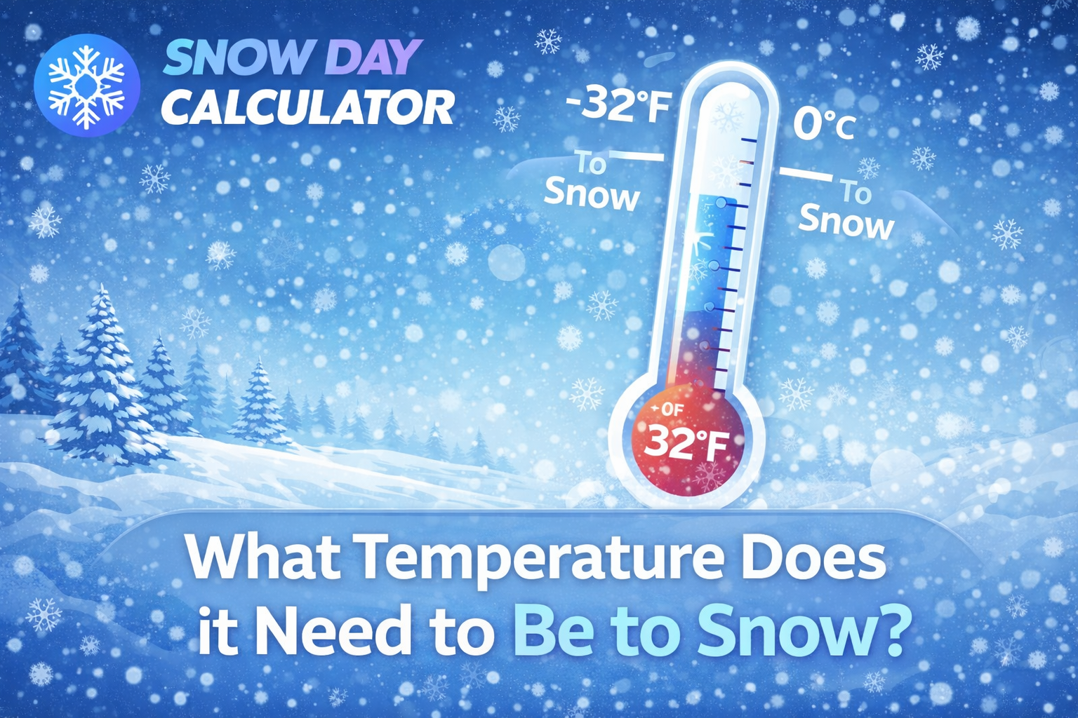
Snow in the South: what it takes
You need three precise ingredients: shallow surface cold that undercuts milder air aloft, a slow-moving wave along the Gulf or Southeast coast to feed moisture, and sustained subfreezing surface temps during the heaviest precipitation.
Miss one and you get cold rain or a thin glaze of ice. Hit all three and a narrow corridor from northern Texas to the Carolinas can pile up several inches in 6–12 hours. These events show up best 24–72 hours out; rely on high-resolution forecasts for the final call.
How this winter compares to last
Many northern and interior cities look set to improve on last winter’s totals, with several nudging back toward historical norms. That does not guarantee a top-10 season, but it does suggest a return to regularly scheduled winter programming: shoveling days, slippery commutes, and the occasional school delay.
For coastal cities in the Mid-Atlantic and southern New England, totals may still trail long-term averages, yet the odds of at least one memorable event rise when cold precedes coastal development by a day or so.
The bottom line by latitude
North of roughly 40°N, you should prepare for a winter that feels familiar—cold enough, often enough, with multiple legitimate snowmakers. From about 35–40°N, outcomes hinge on timing; you’ll get snow chances, but you must thread the needle. South of 35°N, your best bets cluster around short, sharp Arctic blasts that arrive with just enough moisture. Every region has a path to snow, but the northern route is the straightest.
Quick answers to common questions
Will it snow more than average where I live? If you’re in the Pacific Northwest, Northern Rockies, Upper Midwest, or interior Northeast, your odds lean that way. Coastal Mid-Atlantic and southern New England trend closer to average or a bit below, but a single big storm can change the final tally.
When should I expect the first measurable snow? For the northern tier, target late November to early December. For the I-95 corridor, your first credible shot often waits for an early-season cold snap—frequently early December. Farther south, you usually need January or February.
Are big East Coast Nor’easters on the table? Yes, particularly late January into February when the cold pool deepens. Interior zones and elevated suburbs profit first; the urban coast needs preloaded cold.
Will the South get snow? Some places will, but short windows rule. Watch for Arctic fronts paired with Gulf moisture. These events tend to be fast, intense, and localized.
Should skiers expect a good season? Northern and high-elevation resorts in the Northwest, Northern Rockies, and parts of the Northeast have favorable signals. The central and southern Rockies do better when cold undercuts arriving Pacific moisture; timing will decide the winners.
Final takeaway
Is it going to snow this year? Yes—especially for the northern half of the country and higher terrain out West. The pattern supports frequent cold shots, a healthier storm track, and improved odds compared with last year for many interior and northern cities.
Plan around early December for your season’s kickoff and circle early February for a second act. Keep plans flexible, respect short-range updates, and you’ll thread the needle between winter’s best days on the slopes and its trickiest days on the roads.